Introduction of airport meteorological equipment system
From 01/01/2017, Vietnam Air Traffic Management Corporation (VATM) has received Meteorological Services from Vietnam Airports Corporation (ACV). Equipped with equipment that meets international standards that provide 24 / 24h metering for predicting and forecasting weather phenomena for flying activities throughout the region. Civil airports nationwide as well as meteorological information sharing for units with other needs.
Depending on the factors: density of flying activity, weather, geographical location ... the airports are equipped with different meteorological equipment.
1. Meteorological monitoring system: There are two types of meteorological monitoring system: automatic meteorological monitoring system and manual meteorological observation system:
1.1. Automatic meteorological monitoring system:
At present, 21/22 civil airports in Vietnam have been equipped with automatic meteorological monitoring system.
Normally, an automatic meteorological monitoring system is arranged as follows:
Out-door part: The sensors of the Automatic Meteorological Observation System are placed in the Aerodromes at some locations along the runways to measure and collect data on Weather phenomena, visibility ... in the airport area.
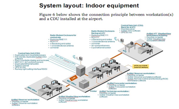
In-door (in-house) AVIMET weather monitoring equipment
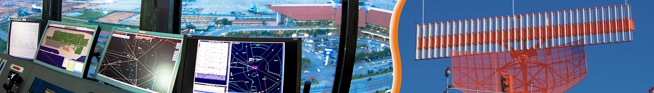
At Noi Bai Airport.
In-door: Gather and process data provided by the out-door equipment to provide weather information in the airport area, then weather information. It will be included in the Meteorological Database System, ATIS system, terminal displays and AFTN terminals for the purposes specified in the introduction of the respective equipment.
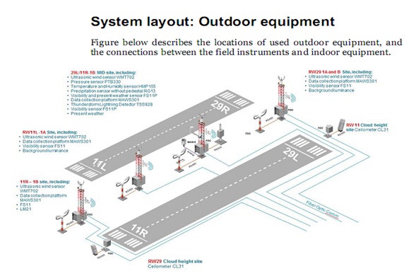
Out-door components (outdoor) AVIMET meteorological monitoring system
At Noi Bai Airport
1.2. Manual meteorological monitoring system: is the meteorological observation system for automatic monitoring systems:
Currently, all civil airports nationwide have been equipped with manual meteorological observation systems.
A manual meteorological monitoring system is used when the meteorological monitoring system automatically stops functioning for some reason.
Handheld monitoring systems are installed in the meteorological garden. Components of a conventional meteorological monitoring system for the aviation industry include: Moisture Meter (Dry Temp, Wet Temp, High Temperature, Low Temperature), Wind Meter Heavy board, light panel), rain gauge, gauge.
2. Aerial Center Automated Notification System (ATIS)
The instrument that facilitates air traffic controllers especially in high flight density.
Information received from automated meteorological monitoring systems, meteorological terminals and ATCs is processed by ATIS server systems, and then transmitted over VHF frequency 127.0 MHz to aircraft within the ATIS. Radius 100km from the airport.
At present, Noi Bai and Tan Son Nhat airports have been equipped with ATIS.
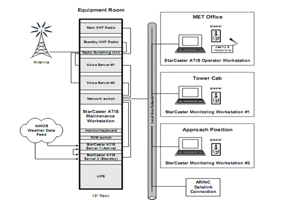
Aerodrome ATIS (ATIS)
3. WAFS SADIS global prediction product acquisition system:
WAFS SADIS collects data from the Met Office Meteorological Center in London via the secure FTP protocol over the Internet.
The above data is provided to the Meteorological Database System and Meteorological Forecast Terminals.
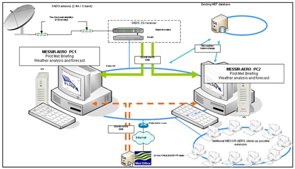
WAFS SADIS system diagram
4. Weather Radar System.
Weather Radar is a tool for detecting and displaying dangerous CB / TCU clouds, thunderstorms and the direction of clouds and other weather events within its range.
Currently, VATM has received two weather radars installed at Noi Bai International Airport and Tan Son Nhat International Airport, operating on C-band (5600-5800 MHz), operating distance 400-480km. The rotation angle of the antenna is 3600, the angle of raising -2 to 900. Peak power ≥250KW. Data from the weather radar after processing will be provided to the Meteorological Database System and other terminal locations.
Vườn khí tượng